Atlas to Accompany the Monograph of the Tertiary History of the Grand Canon District
Sheet VIa detail
Clarence E. Dutton. Washington, D.C. United States Geological Survey, 1882. Large Folio, 20”x17”. Printed by Julius Bien & Co., New York. Lithograph and Chromolithograph images by W. H. Holmes and Thomas Moran. Geologic maps.
The Geologist:
Clarence Edward Dutton (1841-1912) was an American geologist. He was an associate of John Wesley Powell in his survey of the Grand Canyon and worked at the U.S. Geological Survey as a field geologist from 1875 to 1891. Dutton worked primarily in the western United States. Wallace Stegner in Beyond the Hundredth Meridian stated “Dutton first taught the world to look at that country and see it as it was… Dutton is almost as much the genius loci of the Grand Canyon as Muir is of Yosemite.”
The Illustrators:
Sheet VIc detail Sheet VI
William Henry Holmes (1846-1933) was an American geologist and artist who worked in the southwest. He illustrated the terrain and geology of the Grand Canyon area. Holmes did nine of the ten sheets illustrating the Grand Canyon terrain.
Thomas Moran (1837-1926) was a painter and lithographer who helped illustrate the Grand Canyon area. Moran drew Sheet XVIII showing the “Transept Kaibab Vision, Grand Canyon.”
The Atlas:
Sheet XVIII Sheet IX
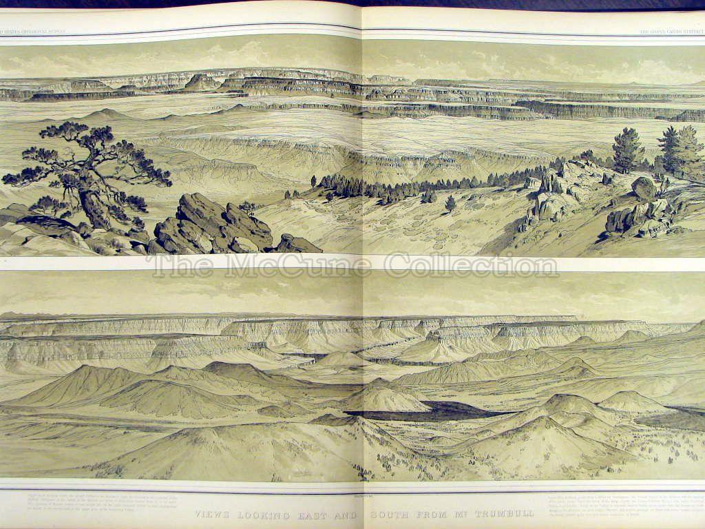
The volume, produced in 1882, contains magnificent panorama views of the Grand Canyon. There are 5 tinted lithographs with an additional 5 chromolithographs with greater color contrasts. There is significant detail in the illustrations. One of them - Sheet VI “Foot of the Toroweap – Looking East” - shows a view of the canyon with a group of men near a pool of water in the foreground. In Sheet XV “Panorama From Point Sublime,” two men are observed on the edge of the canyon, one drawing and the other viewing the drawing. There are also twelve sheets showing the strata of the area. Francis Farquar (Sierra Club leader/ author) described this books as “one of the greatest, if not the greatest, of Grand Canyon books.”

List of the illustrations:
- Sheet IV - The Temples and Towers of the Virgen.
- Sheet V - Looking up the Torowleap from Vulcan’s Throne.
- Sheet VI - The Grand Canyon at the Foot of the Torowleap – Looking East.
- Sheet IX - Views Looking East and South from Mt. Trumbull.
- Sheet X - Views from Mt. Trumbull and Mt. Emma.
- Sheet XV - Panorama from Point Sublime.
- Sheet XVI - Panorama from Point Sublime.
- Sheet XVII - Panorama from Point Sublime.
(Note: These 3 sheets (XV-XVII) form one continuous panorama.) - Sheet XVIII - The Transept Kaibab Vision, Grand Canyon.
- Sheet XIX - Views of the Marble Canon Platform from the Eastern Brink of the Kaibab
Gallery
 Atlas Cover
 Title Page
 Sheet IV
 Sheet V
 Sheet VISheet VIa detailSheet VIb detail
 Sheet VIc detailSheet IXSheet X
 Sheet XV detail
 Sheet XV
 Sheet XVa detail
 Sheet XVb detail
 Sheet XVc detail
 Sheet XVd detail
 Sheet XVI
 Sheet XVIa detail
 Sheet XVIaa
 Sheet XVIaaa
 Sheet XVIb detail
 Sheet XVIc detail
 Sheet XVId detail
 Sheet XVII
 Sheet XVIIa detail
 Sheet XVIIaa
 Sheet XVIIb
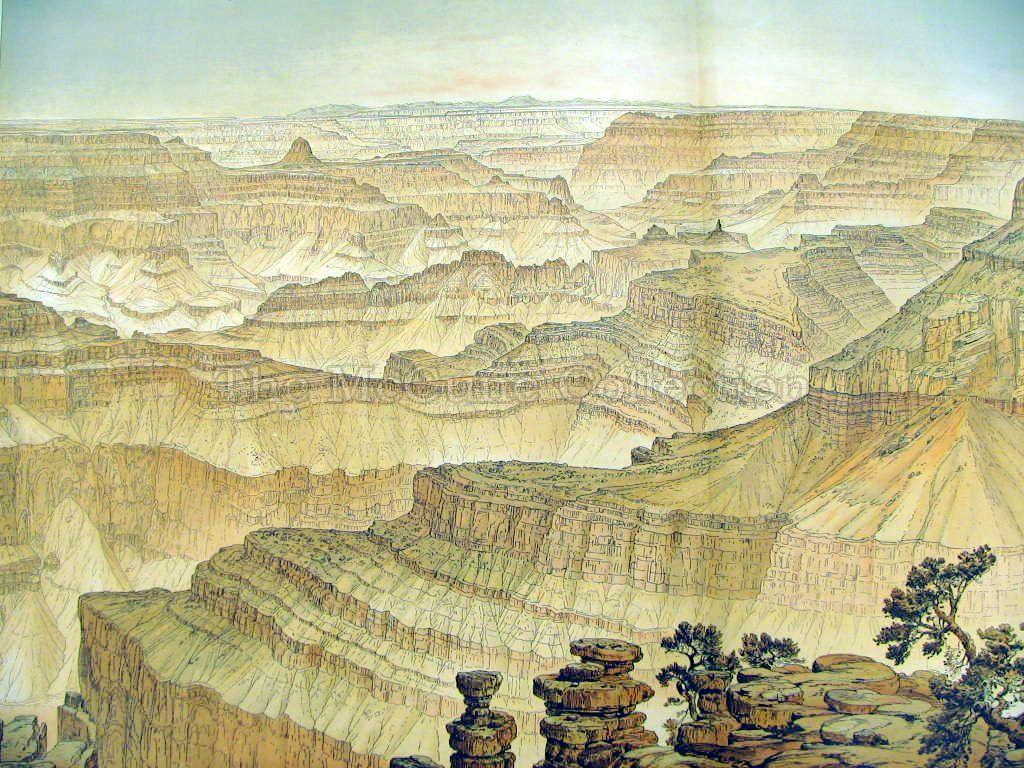 Sheet XVIIISheet XIX